


The rock face rises out of the water like the pipes of an organ, each pipe a near-perfect hexagon. Behind you the reservoir lies flat and blue; in front of you the South China Sea hits the breakwater and throws up white spray. You are standing on a dam in Hong Kong, forty minutes from a city of seven million people, looking at a volcanic formation that geologists fly across the world to see.
This is the East Dam of High Island Reservoir, inside the Hong Kong UNESCO Global Geopark. The columns formed around 140 million years ago, when a supervolcano collapsed and its molten interior cooled into millions of hexagonal pillars (Hong Kong UNESCO Global Geopark, accessed 19 October 2026). Nowhere else in the territory can you walk up and touch them this easily.
At jusha.travel, we love sharing tips that get you out of the shopping malls and into landscapes most visitors never reach. Here is what the geopark is, why the rock looks like this, and how to get there without a car.
What is the Hong Kong UNESCO Global Geopark?
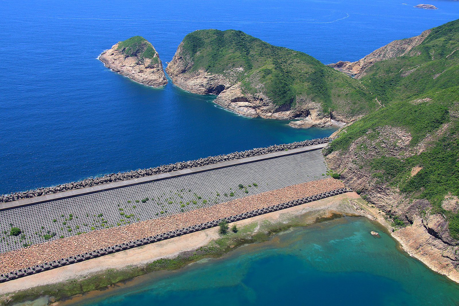
The Hong Kong UNESCO Global Geopark covers more than 150 square kilometres of the eastern and north-eastern New Territories in two geological regions (GovHK, Country Parks fact sheet). Sai Kung holds the hexagonal columns; the north-east preserves a sedimentary sequence spanning 400 million years.
It was inaugurated as a national geopark on 3 November 2009, joined the UNESCO Global Geoparks Network on 18 September 2011, and took its current name in 2015 (Hong Kong UNESCO Global Geopark). The Agriculture, Fisheries and Conservation Department manages it.
Here is the part that confuses first-time visitors: the geopark is a label over country park land, villages and sea, not a fenced attraction. Eight sites, no single entrance, no ticket, no closing time. You pick a site, and the East Dam delivers the most geology for the least effort.
How a supervolcano built this coastline
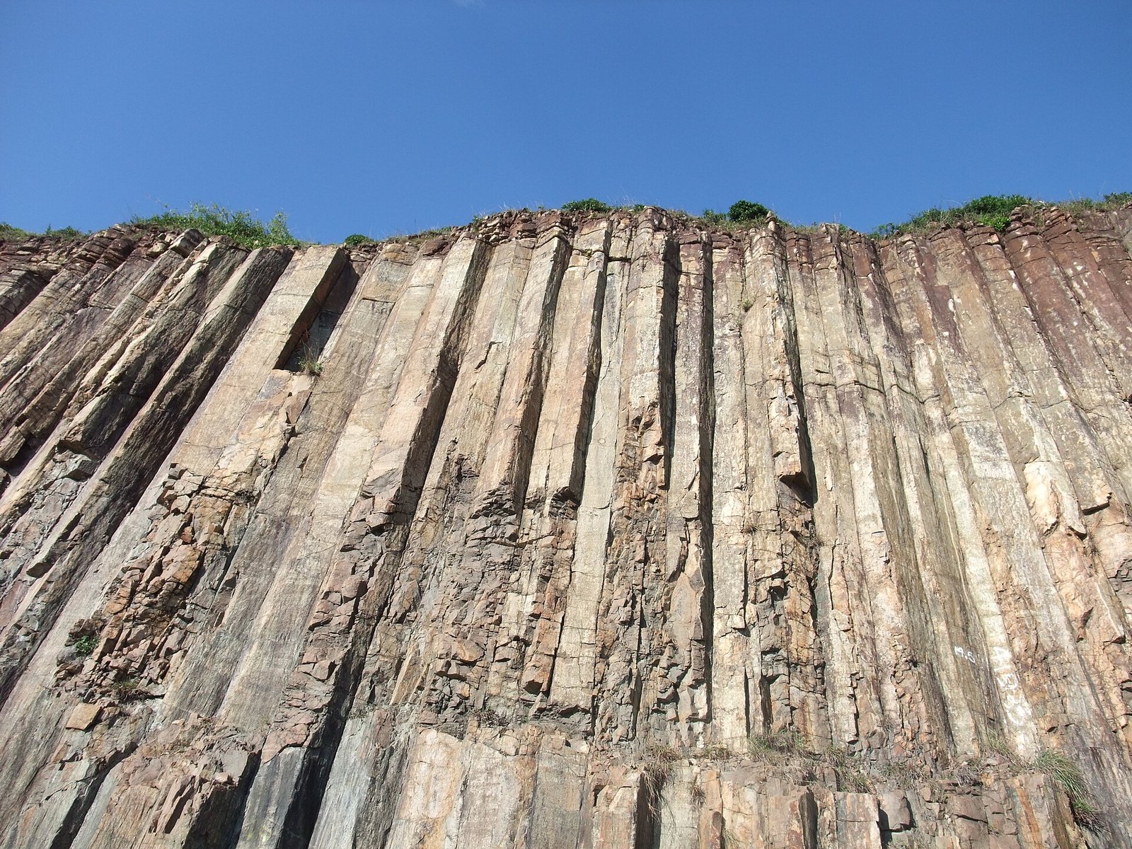
Every hexagonal column in Sai Kung is the cooled interior of one ancient volcano. About 140 million years ago a supervolcano — now called the High Island Supervolcano — erupted across the region, then collapsed into a caldera roughly 20 kilometres long (Hong Kong UNESCO Global Geopark).
Molten rock ponded in the basin and cooled slowly and evenly. As it contracted, cracks opened at roughly 120 degrees and ran downwards, splitting the mass into millions of columns; erosion later cut the cliff faces you see today.
Two details make these columns unusual. They are rhyolitic — silica-rich and pale grey — rather than the dark basalt of most columnar sites, such as the Giant’s Causeway. And they are large: an average of 1.2 metres across, with the biggest around 3 metres, spread over roughly 100 square kilometres of land and seabed (GovHK). In 2022 the formation was named one of the first 100 IUGS Geological Heritage Sites.
East Dam: the rock-column palace
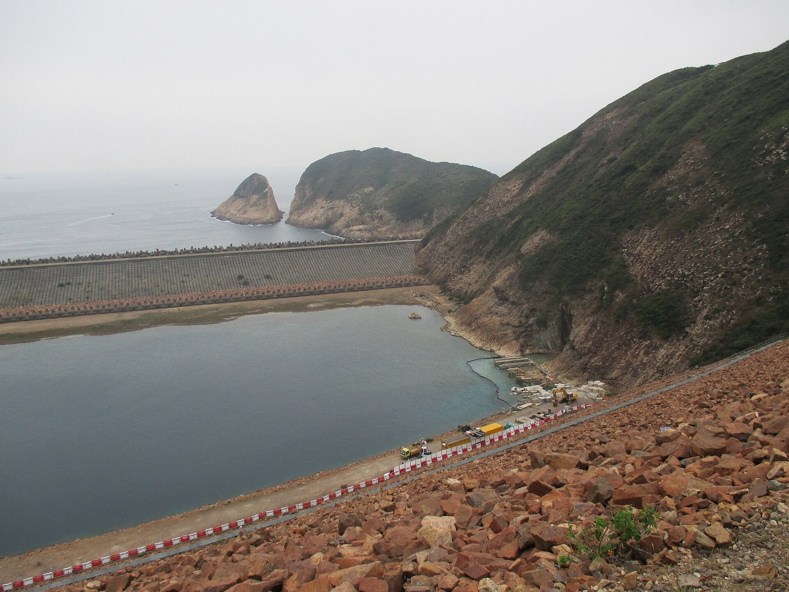
The East Dam is the only place in Hong Kong where you can stand beside the columns at ground level. When engineers built the reservoir in the 1970s, they opened a quarry in the cliff next to the dam, and the cut face exposed the columns in cross-section (Hong Kong UNESCO Global Geopark).
The reservoir was completed in 1978 by sealing a narrow sea channel between High Island and the Sai Kung peninsula. More than 7,000 concrete dolosse, each weighing about 25 tonnes, now shield its seaward side (Pete Spurrier, 29 January 2024).
Walk the dam and you pass a wall of columns, a band of S-shaped columns twisted before the rock set, a fault breccia belt, a sea cave on a boardwalk, and a breakwater of interlocking concrete blocks that looks like sculpture.
Walking the High Island Geo Trail
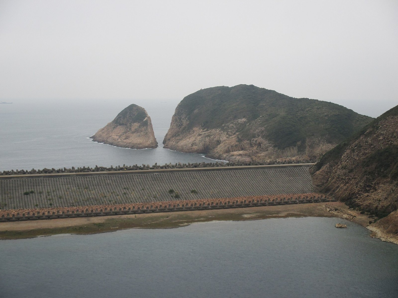
The High Island Geo Trail is an easy, mostly level circuit of about 3.3 kilometres linking the dam’s best features, and the Hong Kong Tourism Board suggests around three hours including stops (Discover Hong Kong).
Interpretation panels explain each feature, so you do not need a guide. This is the order I would follow:
- The blue dolos monument — a memorial to workers who died during construction.
- The column cliff — the quarry face, where single columns run base to tip.
- The twisted columns — a rock face bent into an S before it solidified.
- The fault breccia belt — shattered fragments along a fault line, easy to miss.
- The sea cave — a short wooden walkway leads to the entrance.
- Biu Tsim Kok — a short climb to a 360-degree view over the reservoir and Long Ke Wan.
Po Pin Chau, the sea stack shaped like an organ
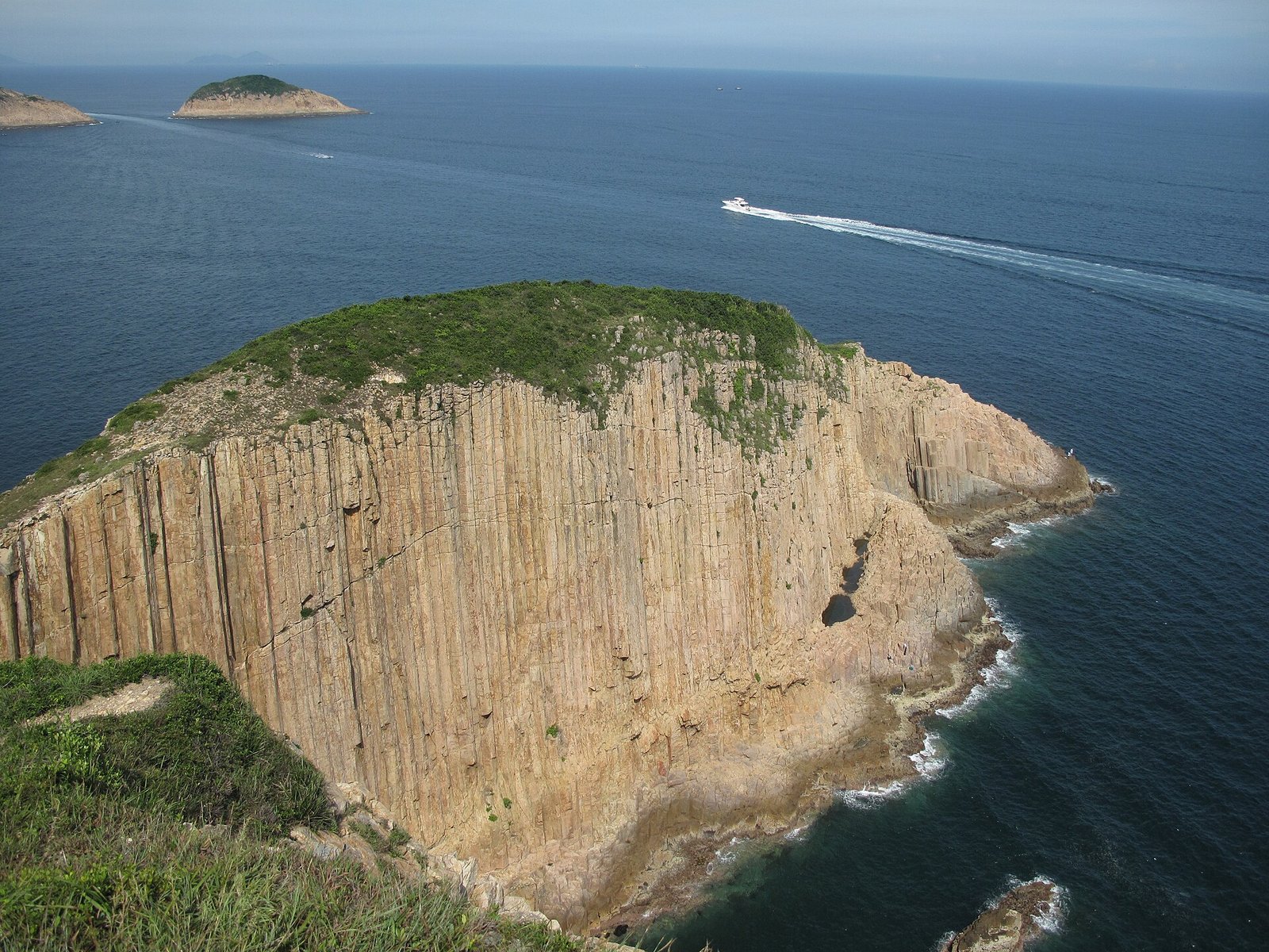
Po Pin Chau is a sea stack — a cliff fragment cut off by erosion — whose face is a wall of vertical columns, like the pipes of a giant organ. It is the photograph everybody wants.
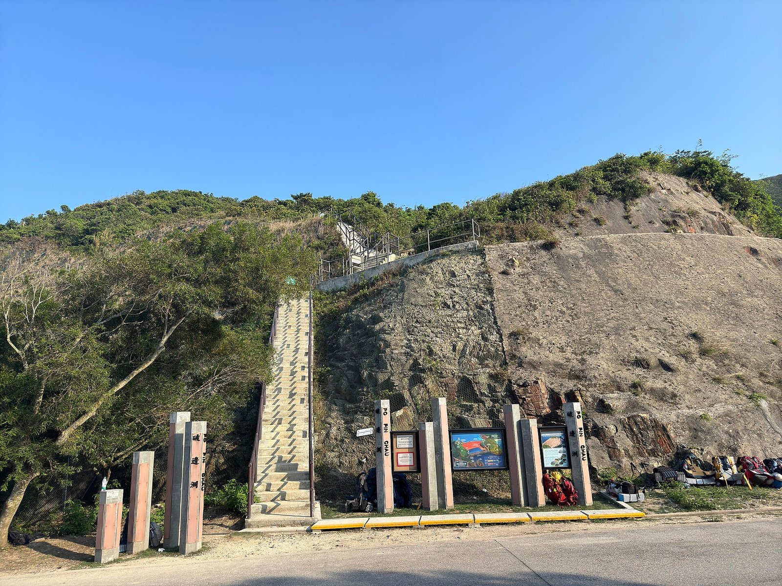
Reach the viewing platform from the start near the High Island Reservoir Monument. The return walk is about 2 kilometres with more than 200 metres of climbing, taking roughly two hours (Hong Kong UNESCO Global Geopark, accessed 19 October 2026).
One warning: a trial booking system applies to the Po Pin Chau Section on selected dates in September and October 2026, with registration through Klook. Check the geopark site first, and never take the old cliff-edge path.
Getting to the East Dam without a car
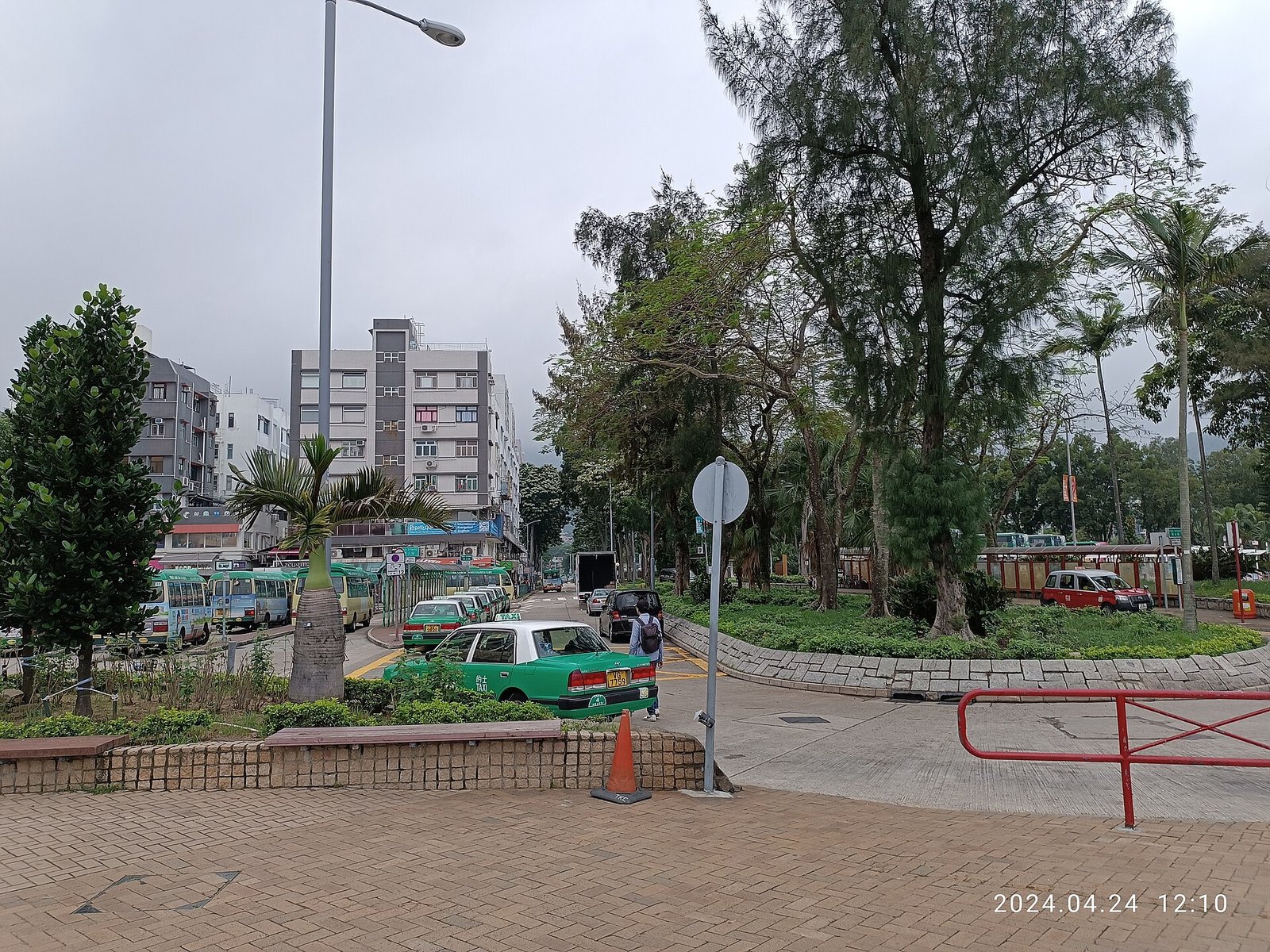
There is no public bus to the dam, so every route ends with a taxi, a minibus or a walk. The trip splits into two legs: city to Sai Kung Town, then town to dam.
| Route | Start | Last leg | Notes |
|---|---|---|---|
| Bus 92 + taxi | Diamond Hill MTR, Exit C2 | Taxi from Sai Kung Town | Simplest from Kowloon |
| Minibus 101M + taxi | Hang Hau MTR, Exit B1 | Taxi from Sai Kung Town | Useful from Tseung Kwan O |
| Bus 94 + minibus 9A | Sai Kung Town | Pak Tam Chung to East Dam | Weekends and public holidays only |
| Bus 94 + walk | Sai Kung Town | 10 km on MacLehose Stage 1 | About 3 hours, no shade |
A taxi from Sai Kung Town takes about 30 minutes and costs roughly HK$140 to HK$160 (Sai Kung travel guide, 2026). Drivers may ask a surcharge to wait, and the Sunday queue at the dam can swallow an hour, so agree a round trip or walk out to the 9A stop.
When to go
The geopark is at its best in the cooler, clearer half of the year.
| Season | Conditions | Crowds |
|---|---|---|
| October to December | Dry, clear, roughly 20 to 27°C | Heavy at weekends |
| January to March | Coolest, occasional haze | Quiet on weekdays |
| April to September | Hot, humid, typhoon season | Beaches and boats busy |
Mornings beat afternoons: the light rakes across the columns and the taxi queue is short. In summer, check the typhoon signal — the dam is fully exposed, with nowhere to shelter.
Practical tips for your visit
- Water: there are no shops and no refill points at the dam; carry at least two litres per person.
- Sun: shade is almost nonexistent on the dam, so bring a hat, sunscreen and sunglasses.
- Footwear: grippy trainers or trail shoes; the concrete and rock are uneven.
- Toilets: use them at Pak Tam Chung before the last leg; facilities at the dam are limited.
- Rules: collecting rocks, sand or plants in a country park is an offence, and drones need a permit.
- Cash: taxis and village shops may not accept cards, so keep small notes.
- Timing: start before 9am to dodge both the heat and the return queue.
Beyond the dam: Sai Kung and the coast
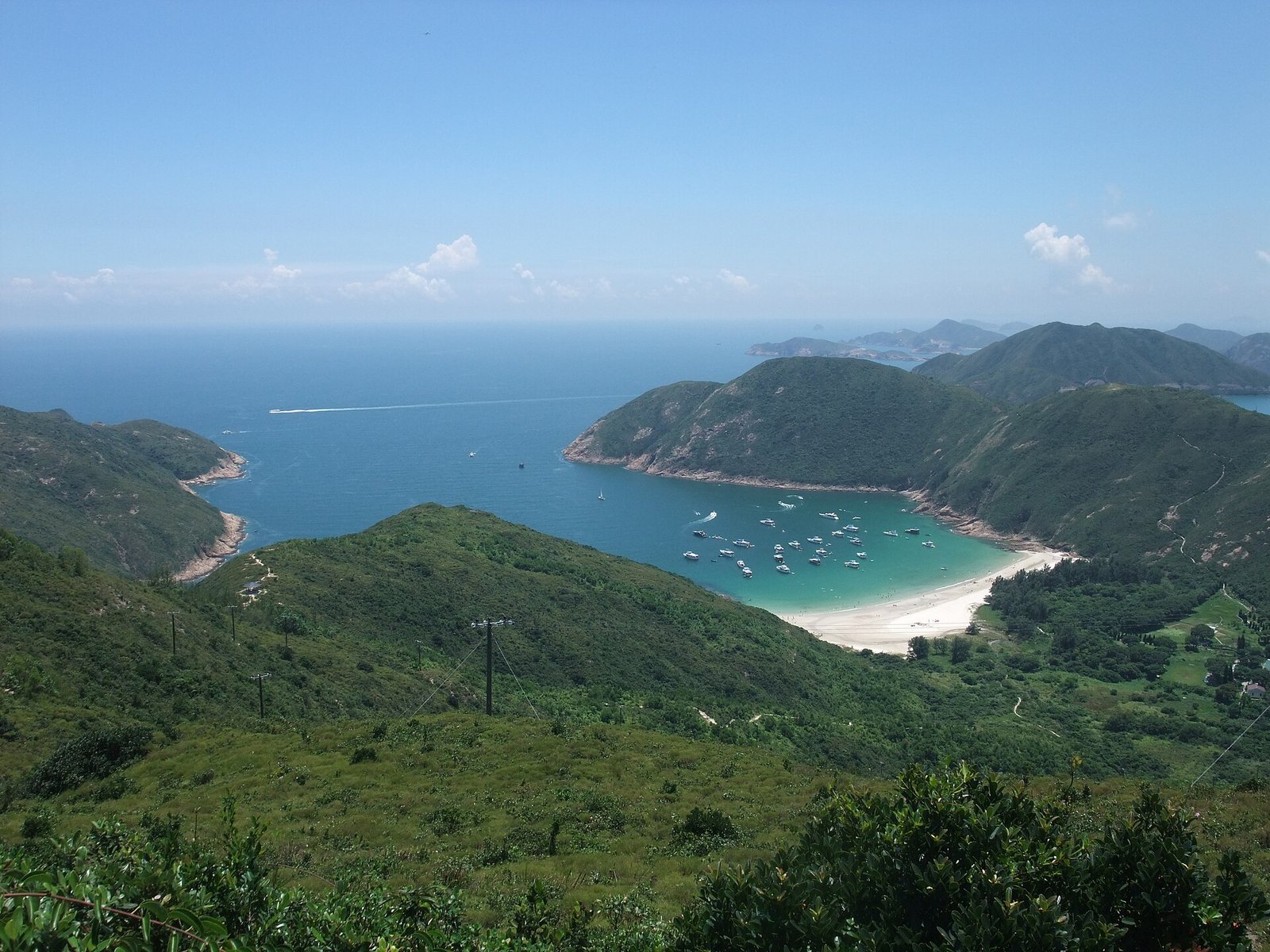
The dam is the headline, but the surrounding country park justifies a whole day. Long Ke Wan, visible from Biu Tsim Kok, is a white-sand bay that looks borrowed from Thailand; further east, Tai Long Wan is a chain of surf beaches reached only on foot or by boat.
Back in Sai Kung Town, the waterfront is lined with seafood restaurants where you pick your fish from tanks and agree a price first; our guide to Sai Kung’s seafood and coastal charm covers what to order.
Hikers can extend the day on MacLehose Trail Section 1 from Pak Tam Chung, or Section 2 out to Pak Tam Au. If ridge walks are more your thing, our post on Sunset Peak and its silvergrass sea covers Hong Kong’s other great autumn hike.
Why the geopark belongs on your Hong Kong itinerary
Hong Kong sells itself on skyline and shopping, but the geopark is the counter-argument: a UNESCO-recognised volcanic landscape you can reach on the MTR and a taxi, with no queue and no ticket. It is also the easiest place in Asia to understand deep geological time with your hands rather than a textbook.
Give it half a day and start early. If you would rather pair the columns with village life, our guide to Tai O’s stilt-house fishing village makes a good second stop on the same side of the territory. Tell us in the comments which formation surprised you most.
Frequently asked questions
Is the Hong Kong Geopark free to visit?
Yes, it is free. There is no entrance fee or booking for the East Dam, the Geo Trail or the country parks around them; you pay only for transport, with a taxi from Sai Kung Town around HK$140 to HK$160 each way.
How do I get to the High Island Reservoir East Dam?
Take the MTR to Diamond Hill and bus 92 to Sai Kung Town, then a taxi for about 30 minutes to the dam. On Sundays and public holidays, minibus 9A also runs from Pak Tam Chung to the East Dam; on weekdays the taxi is effectively the only direct option.
Can you touch the hexagonal rock columns?
Yes. The East Dam is the one geopark site where you can walk up to the columns and touch them; the Geo Trail runs along the dam and past the quarry face, with no climbing required.
How long does the High Island Geo Trail take?
Allow about three hours for the 3.3-kilometre Geo Trail including photo stops, and around two hours more if you add the Po Pin Chau viewing platform, which climbs over 200 metres.
Do I need to book the Po Pin Chau viewing platform?
Sometimes. A trial booking system covers the Po Pin Chau Section on selected dates in September and October 2026, booked through Klook; outside those dates it is open, but check the geopark site first.
Is the geopark suitable for children and older visitors?
Yes. The dam top and Geo Trail are paved and largely level, making this one of Hong Kong’s more accessible countryside outings. The climbs to Biu Tsim Kok and Po Pin Chau are steeper, and shade is scarce.